
Distance from Ella – 28.5 km (1 hour 3 minutes)
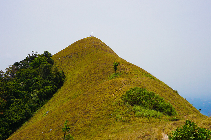
Narangala is a picturesque and magnificent mountain situated in the Badulla district of Uva province. The beautiful Narangala Mountain rises up to about 1527 meters and is the second highest mountain in the Uva province. The mountain is special in two ways. First is that it has two parts of one which is a rectangular shaped plateau and the other one being a triangular shaped peak. The other specialty is the location of the Narangala Mountain. It is located at the edge of Uva while pointing out towards a gap formed between the valleys of Uma oya, Badulu oya and Loggal oya. This gap opens up a wide view towards the Mahaweli flood plains which extends up to Trincomalee.
Getting to Narangala
From Ella take the Wellawaya-Ella-Kumbalwela Highway. Then turn to the Bandarawela – Badulla Road. Go passing Kumbalwela, Demodara, Ketawala. Go down Ketawala-Galauda Road to find Narangala.
The hiking trail starts at the Thangamalai estate area. You should stop your vehicle at the Hindu temple in the estate. Go along the foot trails of the estate until you find a large pipeline which supplies water to the tea estate. Follow the pipe until the point that it reaches a road that runs through the estate. After following the estate road for a while you will reach the point from which you start the climb up the mountain. The first part of the climb will be through a grove of turpentine trees. This path is very slippery because of the leaves which fall from the trees.
Google Location