Customize Consent Preferences

We use cookies to help you navigate efficiently and perform certain functions. You will find detailed information about all cookies under each consent category below.

The cookies that are categorized as "Necessary" are stored on your browser as they are essential for enabling the basic functionalities of the site. ... 

Always Active

Necessary cookies are required to enable the basic features of this site, such as providing secure log-in or adjusting your consent preferences. These cookies do not store any personally identifiable data.

No cookies to display.

Functional cookies help perform certain functionalities like sharing the content of the website on social media platforms, collecting feedback, and other third-party features.

No cookies to display.

Analytical cookies are used to understand how visitors interact with the website. These cookies help provide information on metrics such as the number of visitors, bounce rate, traffic source, etc.

No cookies to display.

Performance cookies are used to understand and analyze the key performance indexes of the website which helps in delivering a better user experience for the visitors.

No cookies to display.

Advertisement cookies are used to provide visitors with customized advertisements based on the pages you visited previously and to analyze the effectiveness of the ad campaigns.

No cookies to display.

Kandy

Kehelpathdoruwa

Kehelpathdoruwa is a hiking area which is situated in the central highlands of Sri Lanka.

Distance from Kandy – 58.0 km (1 hour 48 minutes)

Introduction to Kehelpathdoruwa

Kehelpathdoruwa is a hiking area which is situated in the central highlands of Sri Lanka. It is located en route to Yahangala, which is also a popular hiking spot. Kehelpathdoruwa has a higher elevation and better views in comparison to Yahngala. However, Kehelpathdoruwa is not as popular as the latter. Hence it is a bit difficult to get directions. Even some of the locals are not aware of it and would most probably give directions to Yahangala. Hikers can get directions from some of the locals in the Kalugala village who know about Kehelpathdoruwa.

Hiking Kehelpathdoruwa

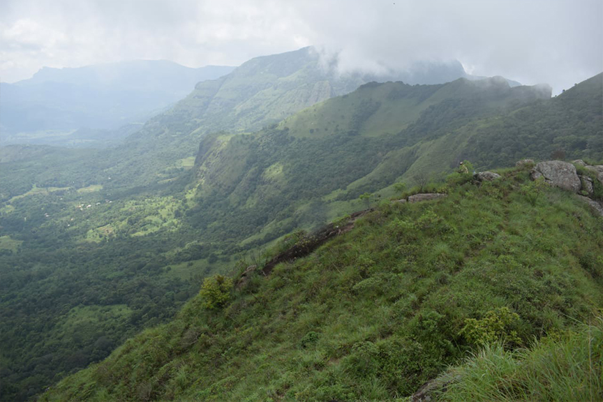
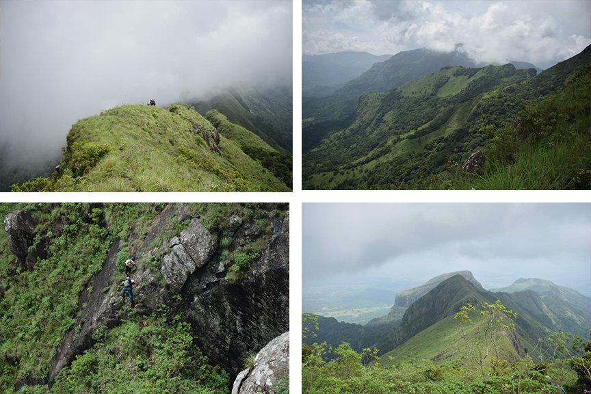
The mountain range is known as “Kehelpathdoruwa” because it takes the shape of a branch of a banana tree. It is a long hike which involves a lot of walking. It can take approximately 2 hours to reach the top of Kehelpathdoruwa. The view at the summit is stunning. Yahangala, Randenigala Dam, Rantambe Dam and the village of Mahiyanganaya are visible from the top of Kehelpathdoruwa. It is also very misty at the top, but the hike is worth it because of the amazing vistas.

Getting to Kehelpathdoruwa

From Kandy travel along the Kandy-Mahiyangane-Padiyatalawa Highway passing Tennekumbura, Pallekele, Digana, Teldeniya, Rambukwella, Hunnasgiriya and Ududumbara up to Kalugala to reach Kehelpathdoruwa.

Google Location